Advanced Network Analysis with Octave Alto Feature Analyser
Octave Alto Feature Analyser enables powerful spatial analysis across complex network data, helping organisations uncover patterns, validate data integrity and make more informed operational decisions. Designed for scalability and precision, it supports deeper insights across utilities, telecoms and enterprise environments.
Enterprise Network Intelligence
IMGS Enables Organisations to Analyse, Validate and Unlock the Full Value of Their Network Data Using Advanced Spatial Intelligence
Octave Alto Enterprise Feature Analyser enables advanced spatial analysis across complex network datasets, helping organisations identify patterns, validate data quality and gain deeper insight into their infrastructure. Designed for utility, telecom and enterprise environments, it supports efficient data interrogation and rule-based analysis to ensure network integrity, improve decision-making and reduce operational risk.
With powerful processing capabilities and seamless integration into existing workflows, it allows teams to work with large volumes of data quickly and accurately, turning complex network information into actionable intelligence.
Advanced Network Analysis
Gain deeper insight into your network through powerful spatial and rule-based analysis. Identify patterns, dependencies and relationships within complex datasets to support better planning and decision-making.
Data Validation and Integrity
Ensure your network data is accurate, consistent and fit for purpose by identifying errors, gaps and inconsistencies. Improve data quality and reduce risk across your operations.
Octave Alto Enterprise Feature Analyser Key Features
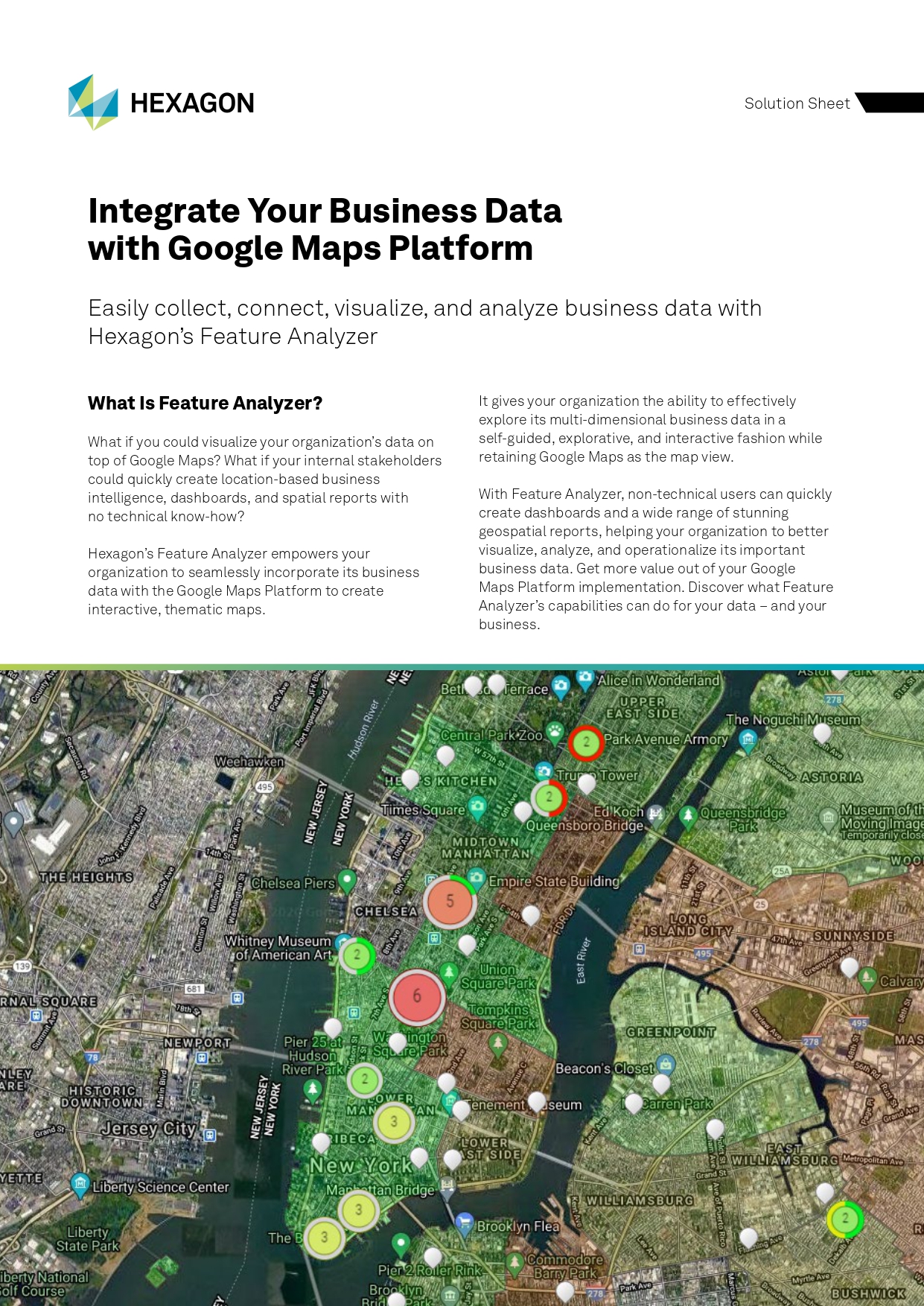
Feature Analyser gives your organisation the tools to collect, connect, visualise and analyse business data in one intuitive environment, powered by Google Maps.
Centralised Data on One Map
Store, host and visualise your business data in a single view, enabling teams to explore and operationalise information directly within Google Maps.
No-Code Dashboards and Analytics
Create powerful dashboards and business intelligence tools without coding, allowing users to interact with live and historical data instantly.
Data Collection and Workflow Automation
Build web forms and mobile apps to collect data, update systems and streamline workflows across your organisation.
Spatial Filtering and Data Exploration
Apply spatial filters to organise, refine and explore your data, uncovering deeper insights through location-based analysis.
Hot Spot and Trend Analysis
Identify patterns, trends and time-based insights across your data to support better planning and decision-making.
3D Data Visualisation
View and analyse your data in 3D, including distance calculations and advanced visualisation of complex assets.
Connect Seamlessly to Your Data with Feature Analyser
Feature Analyser makes it easy to connect and work with your existing data sources, allowing you to quickly bring together geospatial and business data into one unified environment.
With support for a wide range of industry-standard formats and services, you can start visualising and analysing your data without complex setup or development.
Feature Analyser Brochure
Get an overview of Feature Analyser, including its core capabilities, data visualisation features and how it integrates with the Google Maps Platform to support business intelligence and spatial analysis.
M.App Enterprise Solution Brochure
Learn more about the M.App Enterprise platform, including how it supports data integration, application development and scalable geospatial solutions across your organisation.