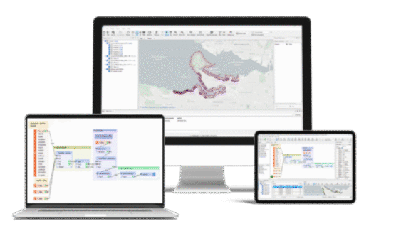
Powerful Data Integration with FME Form
FME Form is the desktop integration platform from Safe Software that enables organisations to connect, transform and automate data across systems without writing complex code.
Where Your Solutions Are Built
FME Form is is a powerful no-code platform for creating automated data workflows, with a particular focus on spatial data transformation, integration and validation.
FME empowers countless people to do more with their data, every day. Job roles that benefit from FME include C-Suite decision makers, IT decision makers and GIS and data analysts.
Simplify data and application integration and make your data work for you. Author workflows in FME Form and automate them with FME Flow to run spatial and non-spatial data integrations on a schedule or in response to events.
The Only All-Data Any-AI Platform There Is And No Code
FME connects your data across systems, formats and environments. Whether you are managing large scale ETL processes, improving spatial data quality or automating complex workflows, FME gives you the tools to move, transform and trust your data with confidence.
- Connect. Transform. Automate.
FME supports hundreds of data formats and systems, allowing you to integrate spatial and non spatial data without complex development. From real time streaming to large scale batch processing, FME handles data movement with flexibility and control.
- Built for Enterprise Workflows
Whether you are integrating enterprise systems, improving GIS workflows or enabling seamless data replication, FME scales with your organisation. It supports automation, reuse and deployment across desktop and enterprise environments, helping you deliver measurable operational outcomes.
Built for the Modern Enterprise
From real time processing to enterprise integration and flexible deployment, it gives organisations the control and scalability needed to manage complex data with confidence.
Automated Integration
Connect people and systems with smart data automation. Keep everything in sync and running smoothly.
Application Integration
Link your favourite apps together to avoid double data entry and improve flow across departments.
Real-Time Data Processing
Process Data from events, steams, IoT devices, live spatial feeds as it happens, giving you instant visibility and insights.
No-Code Web Apps
Deliver the workflows built with FME Form using web applications so your entire organisation can use them.
Flexible Deployment
Deploy FME Flow wherever you need it, on-premises, in the cloud or using hybrid setups, that combines the best of both worlds.
Rest API Power
Use the Rest API to integrate and control FME Flow with other platforms, giving you complete flexibility.
One Platform. Three Powerful Tools. Build, Deliver and Host with IMGS and the FME Suite.
FME Form
No-code environment to build your data workflows. Ideal for creating powerful integrations without complex code.
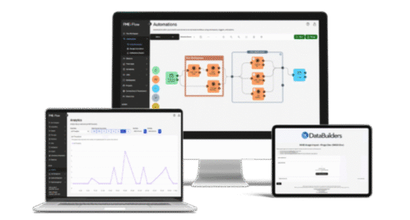
FME Flow
Deploy your workflows and scale your data processing by automating, integrating and delivering data to your whole organisation.
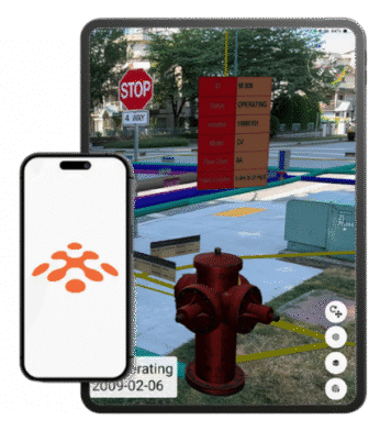
FME Realize
Extend the power of the FME Platform to spatial computing and delivery real-time insights through Augmented Reality (AR).
Simplify ArcGIS Content Discovery with Ripple
Many organisations struggle with siloed ArcGIS environments, making it hard to track content, understand dependencies, or maintain oversight. Ripple, powered by FME, removes these barriers by automatically discovering and visualising complex relationships. All content, users, and groups are brought together in a unified, interactive dashboard, complete with one-click Relationship Reports, which gives your team clarity, control, and actionable insights.
Using Spatial Data For the Enterprise
Spatial Data for the Enterprise For Dummies, Safe Software Special Edition, provides an overview of spatial data usage to elevate your organisation as pioneers of integrating spatial data. Safe Software and its Feature Manipulation Engine (FME) platform empower you to make the most of spatial data across your organisation.
This e-book provides a layout of the spatial data universe to help you better understand the technology used to harness its power.