Leverage Your Geospatial Data with Octave GeoMedia
Octave GeoMedia helps organisations extract meaningful insights from evolving spatial data. By unifying multiple data sources in a single map view, GeoMedia enables teams to process, analyse, visualise and share geospatial intelligence with precision, speed and efficiency.
Octave GeoMedia
Turn Complex Spatial Data Into Clear Insight
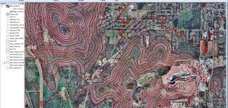
Maps present data visually, allowing you to visualise locations and extract additional insights from your data. Making the information-gathering process easier, making a good map requires powerful analytical tools and clear symbolisation. Whether updating land and tax records, analysing traffic flow and accidents, or determining the best locations for evacuation centres, Octave GeoMedia combines tabular and geographic data to produce actionable information.
GeoMedia is a powerful, flexible GIS management platform that lets you aggregate data from a variety of sources and analyse them in unison to extract clear, actionable information. It provides simultaneous access to geospatial data in almost any form, with support for over 300 data formats including CAD, GIS and database systems and displays it in a single unified map view for efficient processing, analysis, presentation, and sharing. With both 2D and 3D visualisation capabilities, real-time data updates and fully customisable workflows, GeoMedia is ideal for extracting meaningful information from dynamically changing data to support smarter, more informed decision-making. GeoMedia also adheres to open OGC standards, including WMS, WFS and WCS protocols, ensuring seamless interoperability and data sharing across platforms, teams and enterprise systems.
GeoMedia’s functionality makes it ideal for extracting information from an array of dynamically changing data to support informed, smarter decision-making.
Next-Level Automation for Utilities
Utility organisations use GeoMedia to plan, operate and manage infrastructure more efficiently. By combining geospatial intelligence with smart workflows, and real-time data updates, utilities teams gain deeper visibility into their networks and assets, ensuring decisions are always based on current, accurate information.
Real-Time Insights for Smart Cities
GeoMedia enables city leaders and planners to analyse urban data in real time. Dynamic data updates mean visualisations and analyses reflect the latest conditions automatically, helping create more efficient and responsive cities without the need to redo work as data evolves.
Safer Transportation Networks
Transportation agencies rely on GeoMedia to analyse road networks, monitor traffic patterns and identify areas requiring maintenance or intervention. Advanced network modelling and dynamic segmentation tools provide the precision needed to ensure safe, well-maintained travel infrastructure.
Actionable Intelligence for Public Safety
Public safety teams use GeoMedia to analyse live queries, identify incident hotspots and review historical data through temporal analysis tools. These insights support faster responses, better resource allocation and more effective long-term planning.
Octave GeoMedia Resources
Explore key documentation and product guides for GeoMedia. These resources provide a deeper look at the platform’s capabilities, recent updates and how organisations use GeoMedia to manage, analyse and visualise geospatial data more effectively.
GeoMedia Product Overview Brochure
Discover how GeoMedia helps organisations turn complex geospatial data into clear, actionable insight. This brochure provides an overview of the platform’s core capabilities, including data integration, spatial analysis, visualisation and workflow automation for mapping, infrastructure and decision-making.
GeoMedia Add-on
Octave ImageStation's High Volume Photogrammetry and Production Mapping
Over 40 years of photogrammetric technology development goes into ImageStation, starting with analytical stereoplotters and progressing through the current full suite of software applications. ImageStation has applications for your entire production workflow including project creation, automatic triangulation, GIS and CAD-based stereo feature and DTM collection and editing, automatic DTM and digital surface model (DSM) generation, and automatic orthophoto production and editing from aerial and satellite imagery.
ImageStation is designed with a high degree of automation for high-volume photogrammetry and production mapping customers who need to process large quantities of raw spatial information rapidly and accurately into an actionable format.

Includes applications for automatic triangulation, stereo feature and DTM collection and editing, automatic DTM and DSM generation, and automatic orthomosaic production.

ImageStation components utilise 64-bit processing, multithreading, and distributed processing to maximise throughput for virtually unlimited-sized projects.

Includes GNSS/INS data processing, POSEO support, camera calibration, graphical error analysis, multi-photo point measurement, automatic tie/pass point matching and bundle adjustment of satellite RPCs.

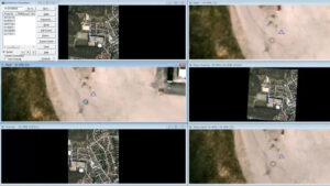
Includes interactive stereo feature and DTM collection and editing with smooth roam, dynamic zoom, and on-the-fly image enhancement directly integrated with GIS and CAD.

Includes ortho project planning, orthorectification, adaptive radiometric enhancements, tone balancing, mosaicking, true ortho capability, and automatic seamline generation.
ImageStation Brochure
An overview of the ImageStation platform and its capabilities for high-volume photogrammetry and production mapping using aerial and satellite imagery.
ImageStation DTM for GeoMedia
Learn how ImageStation integrates with GeoMedia to support terrain modelling, digital elevation data creation and advanced geospatial analysis workflows.