Asset Management System with Hexagon’s GeoMedia Smart Client
![]()
Author: Ciarán Kinane, Applications Engineer at IMGS
Hello everyone and welcome to this month’s blog. This month we are going to focus on map based asset management using hexagon’s GeoMedia Smart Client.
Nowadays people can see the value of GIS within your organization, but they often lack the expertise to run a desktop GIS. Online maps delivered by a web GIS solution are helpful, but these implementations in many cases do not support specific geospatial workflows required by the user. They also may not provide some of the main functionality of a desktop GIS such as snapping etc. Today, users look more and more for market-focused workflows specified to their needs.
The vast majority of people who could really benefit from geospatial data need more than what a lightweight, browser-based web map can deliver. Likewise, they don’t have the time or expertise to learn a technically demanding desktop environment. These users are eager to geospatially accelerate their business workflows and ignite the power of GIS. This requires a new approach, working outside limiting departmental deployments of GIS that have plagued organizations for decades.
This is where GeoMedia Smart Client comes in. It provides a platform for users which is easy to use and does not require the same training or knowledge required by a desktop GIS. Smart Client is delivered to users via a browser and runs on the client machine using Java. The thing I really like about Smart Client is that it only requires 1 license whether you have 5 users or 500 users running concurrently. Smart Client has the ability to open up GIS to your whole organisation.
Here in IMGS we have provided separately configured asset management systems to both Shannon Properties PLC and Sligo County Council using Hexagon Geospatial’s Smart Client. Out of the box functionality provides, measurement, dimensioning, snapping, redlining and configurable printing, but the real power in Smart Client is the ability to create interactive workflows to meet the user’s needs.
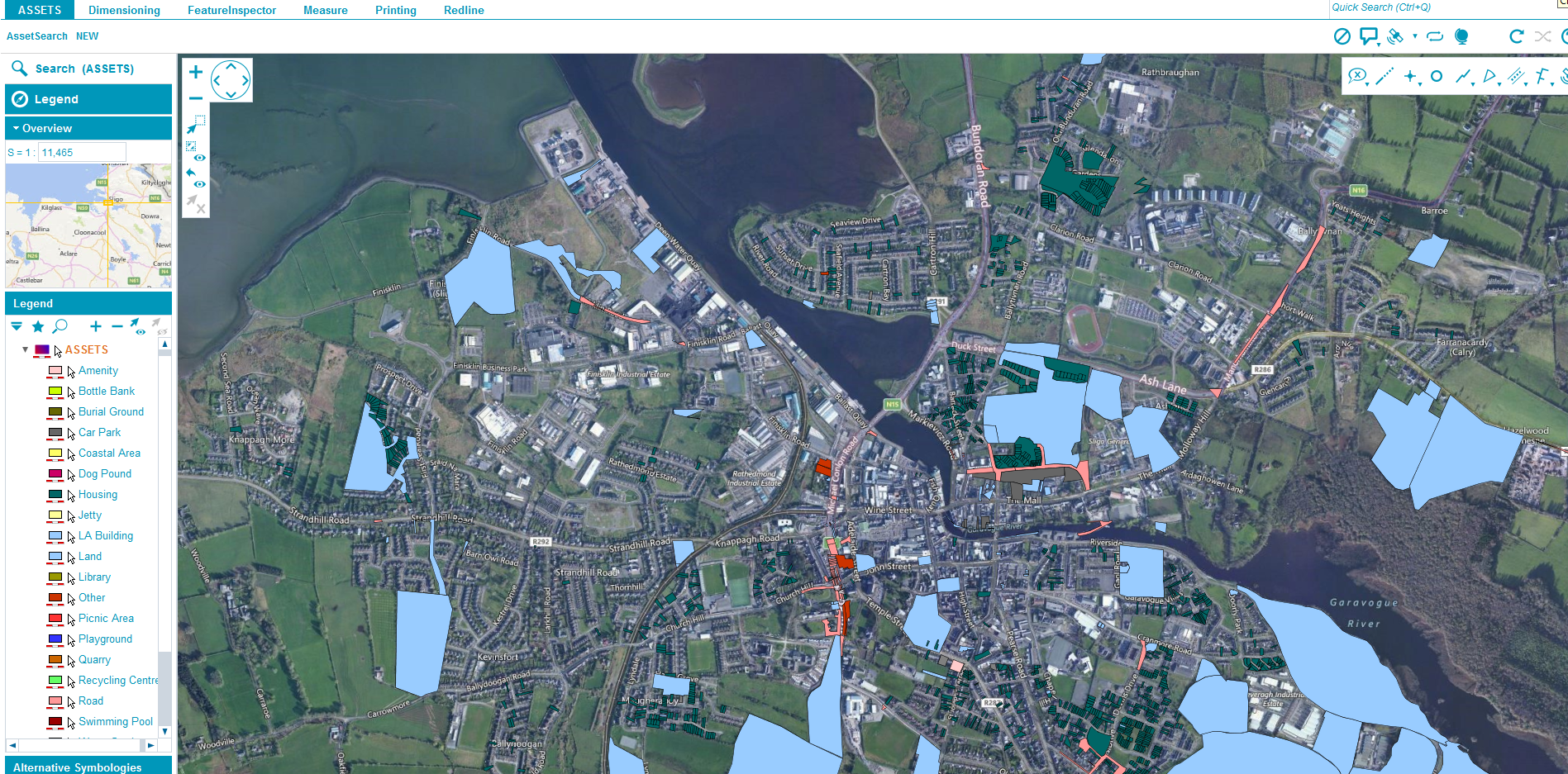
For Sligo County Council we used Smart Client to replace their fully customized map based asset management solution. Using Workflow Manager, which comes with the professional version of Smart Client, we were able to create an Asset Search workflow.
The Asset Search has the ability to filter on multiple attributes within the asset database. For each entry returned in the search, we have the ability to map to, edit or view that asset and sort by any attribute. The asset list can also be printed to csv, excel, word or PDF and can include XY coordinates of the asset, criteria which are a requirement of the Office of Public Works in Ireland.
We also created a workflow which allows the user add a new asset to their system. When the user selects the ‘NEW’ button they are presented with a form whereby the user can enter details pertaining to the asset. The workflow can have many rules to prompt and aid the user with the compiling of asset details. For example, the user can enter no more than 5 digits as the asset number, or the asset ID can be created based on the asset number with a prefix coincident with the asset type specified in a drop down box.

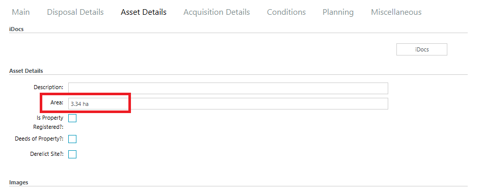
Once the user has entered in the minimum details, they can begin to digitizing the asset in the map window.
While digitizing, the user is afforded many features which would not be available within a web based mapping solution, such as snapping to vector data (as seen on the image below), dimensioning and the ability to scroll the map while in capture mode etc.
Various geometry rules can be applied at this point to guide the users. For instance in the Shannon Properties project they requested some rules which would not allow the user to capture the boundary of a building outside the boundary of a particular site. Another rule requested was to not allow the user to capture the boundary of a site outside a particular Landbank feature. These rules can be applied and guides set in place to direct the user reducing anomalies in the data and standardising your digitizing processes.
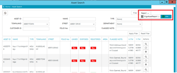
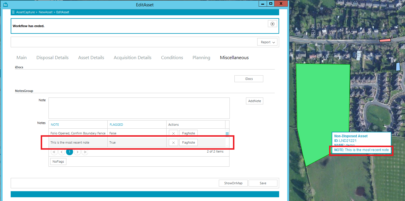
Once captured in the map window, the user is brought back to the workflow where they can enter additional details into attribute fields. The form is comprised of tabs along the top which contain different aspects of the asset such as terms of leasing etc. The area of the polygon is calculated in the database and added into the form. A specific request from Sligo County Council was to show the area measurement in hectares if the area was above 5000 meters squared to have it shown in squared meters otherwise.
The workflow can be configured to calculate and report such things as the townland or townlands the asset was captured in via a spatial query. Adjoining streets or roads can be also calculated in this way and a report can be produced and printed with the associated planning applications.

Other features within the workflow are links to external applications within or outside the organisation such as iDocs., the ability to upload files or images, and the ability to add notes and flag one of the notes so that it then appears as the tooltip for the asset in the map.
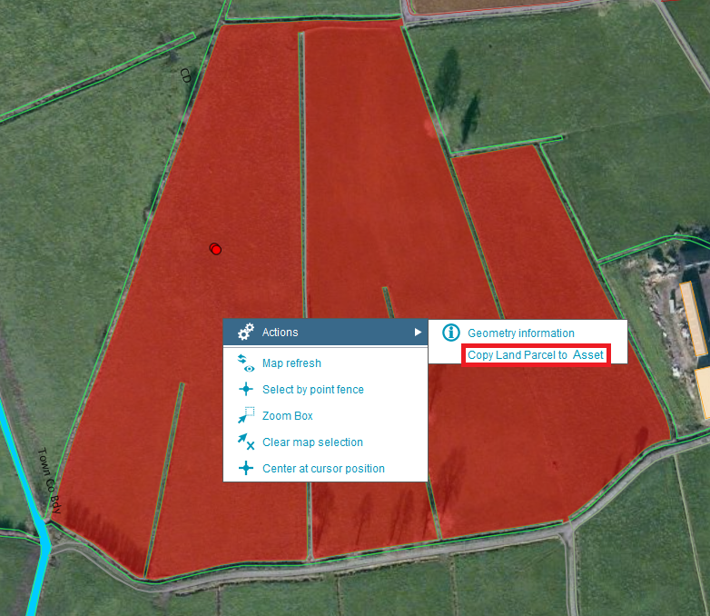
Various actions can be added to the map which can directly open any workflow, for instance the image shows the ability to be able to copy an existing land parcel to one of your assets just by highlighting the land parcel and right clicking the mouse.
Smart Client has some neat features around bookmarking, you can bookmark an area of interest, save it and then e-mail it to other users or you can share the bookmark across your organisation so it is available to all users.
Access to Smart Client can be based on a windows user login and it not only has the ability to restrict users to the application but it also has the ability to restrict windows users to Smart Client Projects, Features, Workflows and even functions within a workflow. So where one user can have the ability to edit an asset other users can be restricted from doing so within the same project or view.
In addition Smart Client can be configured to launch standalone workflows, for instance if a user wants to just add attribute data to an asset they can do so by launching a standalone workflow without having to launch the GIS application.
Overall, Smart Client’s most prominent capabilities are the ability to supply a GIS application to everyone in your organisation without having to license each seat. With a shallow learning curve and the ability to provide customized workflows there is something for everyone in the audience!

For further information on Smart Client please feel free to contact me ckinane@imgs.ie
Asset Management System with Hexagon’s GeoMedia Smart Client Read More »